Lot 286
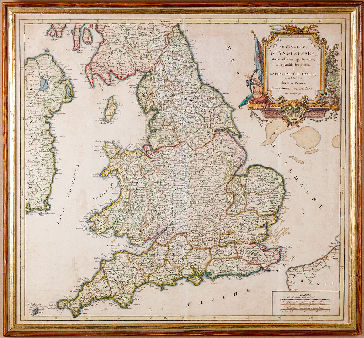
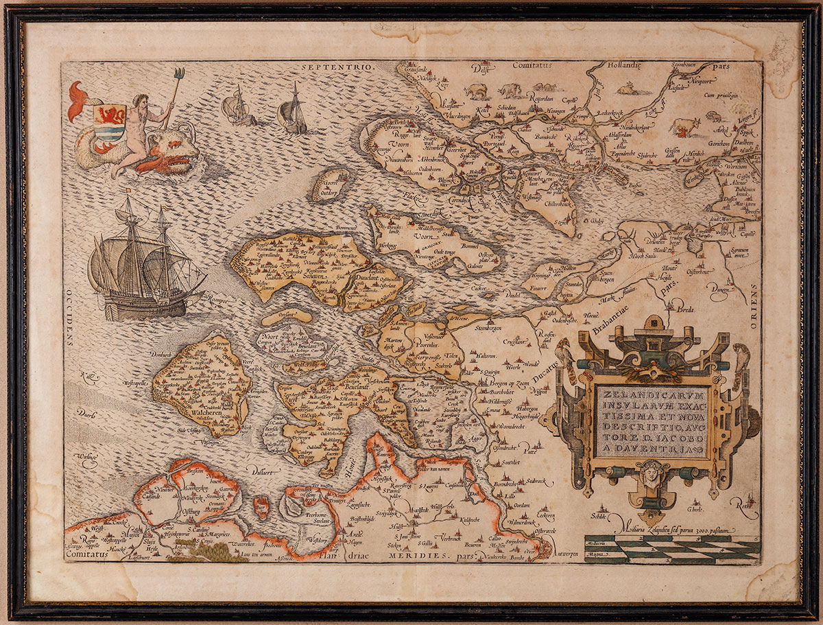
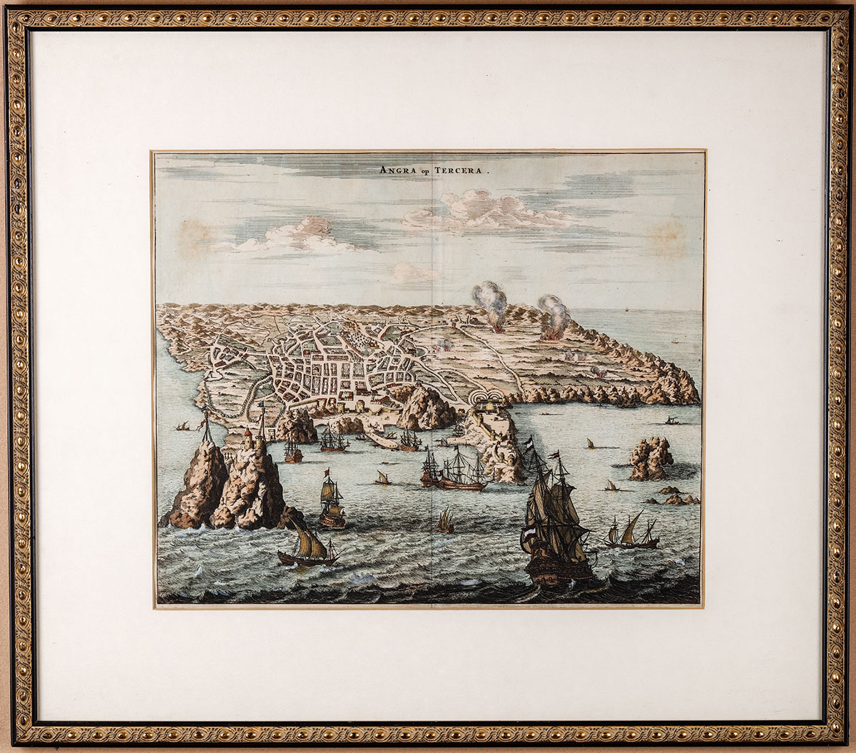
Three ca. 18th-19th Century Copper Engraved Maps of Azores, England, and Europe. Three vintage original late 18th century and very early 19th century copper engraved maps. The most striking Angra op Tercera, 19th century map of the Angra op Tercera, showing the city of Angra and portions of the island in the Azores. Incredibly appealing map with over 12 ships illustrated in great detail, the hand-tinting quite exceptional, the map in fine condition. 11½ x 13½" very nicely matted and framed to 18 x 20". The second a map of England, "Le Royaume d'Angleterre divisé selon les sept Royaumnes, ou Heptarchie des Saxons, avec La Principauté de Galles…." published in France by Robert, 18�" x 20". Showing shires and counties, as well as the towns and cities; also part of Scotland and the eastern edge of Ireland. Matted and nicely framed to 20�" x 22" very good to fine. Finally a map by Ortelius with a large ship under full sail, Neptune with trident riding a sea monster, and large title cartouche. The map extends from Rotterdam and Dordecht in the north to Antwerp in the south, and is based on Jacob van Deventer's map of Zeeland from 1547. 16 x 21 and in good condition with evidence of decades old water stains in borders. $400 - 600
|
| |
| Realized $288 |