Lot 193
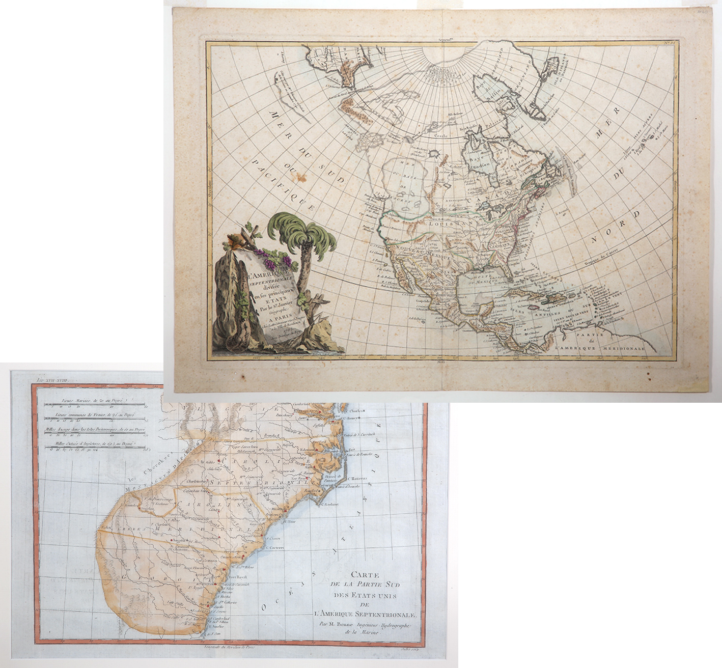
2 Vintage Antique Maps of the Southern United States, Late 1700s. Two exceptional antique maps from the late 1700s. The first by Jean Javier, "L'Amerique Septentrionale Divisee in ses Principaux Etats." The entire southwest is titled Nouveau Mexique and the midwest, Louisiane. Directly above N. Albion (California) is a non-existent Mer Ou Baye De L'Quest. From DeLisle's Atlas Modern. 1762. later editions 1771-1783. Measures 12" x 18, on laide paper, hinge mounted in acid free mat, minor foxing and age toning and with four tiny holes in margins otherwise quite fine. Very attractive, full color cartouche with title. The second map by Rigobert Bonne, "Carte de la Partie Sud des Etats Unis De L'Amerique Septentrionale published in 1770-1780s, 8¼" x 12¼" with full margins. This is one of the four most desireable Bonne maps of the early United States depicting the souther part of the newly emerging country. The area shown extends from St. Mary River in southern Georgia to Chesapeake Bay. Towns, forts Indian tribes, rivers and mountains in relief are illustrated. In exceptional condition, printed on laid paper hinge mounted in simple acid free mat.
Estimated Value $400 - 600.
Estate of Alexander White III From the Collection of Alexander White III.
|
| |
| Realized $504 |