Lot 76
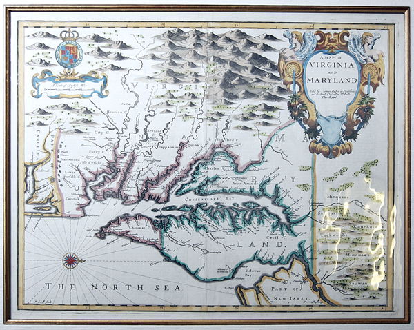
John Speed Map of Virginia And Maryland. By John Speed, London, 1676. 19½ x 15 inches. Hand colored map of Virginia and Maryland, engraved by Francis Lamb. It first appeared in the enlarged edition of Speed's Atlas in 1676.
This is one of the first maps to incorporate the information from Augustine Herrman' s "Virginia and Maryland As it is Planted and Inhabited this present Year 1670 Surveyed and Exactly Drawne by the Only Labour & Endeavour of Augustin Herrman Boehemiensis." An English-text description of Maryland and Virginia appears on the verso.
The majority of the cartographic information derives from John Smith's earlier map of Virginia. Speed's four maps of the English colonies in America were the first "new" set of printed maps of the Colonies to appear in a commercial atlas after the English took control of the territory which became the British Colonies in North America and later the first 13 states.
Estimated Value $4,000 - 5,000.
|
| |
| Realized $3,600 |