Lot 1069
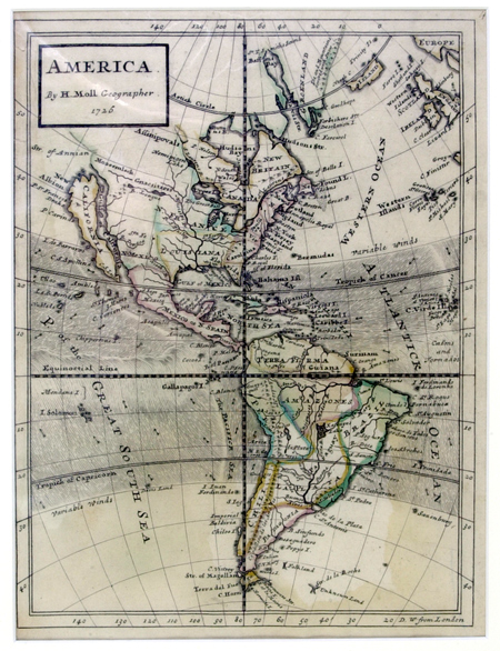
Early Map of North America Depicting the Island of California. Matted to an overall size of 14 x 17". Hand-colored, copper-plate engraving, approximately 9 x 11", n.p., dated 1726. Beautifully preserved early map of "America" depicting an imperfectly known North America, South America, Central America, Mexico, and Canada. The map shows California as an island, separated from the North American continent by the "Gulf of California," surmounted by the speculative "Strait of Annian," and a variety of fancifully named regions. Territorial detail is limited to the Colonies, Louisiana Territory, Canada, and Mexico. The city of Sante Fe is the westernmost territory named. Within the interior, the Great Lakes are prominent as is the Mississippi and its tributaries. Canada and South America are well detailed and obviously well-explored by this time. There is no detail within the Island of California itself. Fine.
Estimated Value $500 - 750.
|
| |
| Unsold |