Lot 564
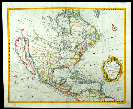
C. 1745 Map of North America Showing California as an Island. "A Map of North America With the European Settlements & Whatever Else Is Remarkable In Ye West Indies From the Latest and Best Observations", by Richard William Seale (1732-85), ca. 1745, printed in London for Tindal & Rapin.
Shows all of North America from the Arctic Circle to the northern part of South America and includes the Caribbean Islands. California is shown as a huge island having an extensive mountain chain down its center, with the "Gulf of California or Red Sea" seperating it from the larger continent.
Measures 18" x 15", with lovely old color and in excellent condition on firm crisp paper. Among the nicest examples of this scarce and popular map that one will see and most suitable for framing and display.
Estimated Value $2,500 - 3,000.
|
| |
| Realized $2,300 |