
|
Sale 9
Manuscript, Collectible and Philatelic Auction
| Lot |
Photo |
Description |
Realized |
Lot 782 |
|
1777 Map of Philadelphia. A Map of Philadelphia and Parts Adjacent. Engraved by N. Scull and G. Heap. Published by Gentleman's Magazine. Circa 1777. Sheet size: 12¾ x 15½". Matted for an overall size of One vertical and three horizontal folds, a small strip of restoration along lower edge, a few pinholes along upper edge in margin, light toning. In good to very good condition overall.
This detailed map of Philadelphia and its surroundings pictures the grid-like center of town, rivers, channels, creeks, and roads. Outskirts, however, are more accurately depicted with individual residences identified by the landowner's name next to a small icon of a house.
Estimated Value $150 - 200.
View details
| Realized
$288 |
Lot 783 |
|
1860s Map of Yokohama. Japanese block print picturing a topical view of Yokohama, Japan, circa 1860s. On rice paper. Sheet size: 36½ x 20½". This colorful display piece details the island settlement and surrounding waterways which had only been opened since 1859. On the island, foreign presence is indicated by international flags that have been pictured over several buildings. A variety of ships sail off the coast, easily identifiable by their flags. Interestingly, a couple of the ships seem to be burning as they appear engulfed with plumes of smoke. Six horizontal and one vertical fold, a few light stains and toning. Still, in very good condition for such an unusual map.
Estimated Value $250 - 350.
View details
| Realized
$230 |
Lot 784 |
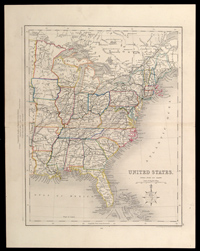 |
1861 Map of the United States. Drawn and engraved by J. Archer. Comprehensive Lengths of England & United States.London: Pentonville, 1861, page. 46, 10¾ x 13½". One horizontal fold, a small split at left end of fold. In very good to fine condition overall.
Detailing the eastern United States, this map clearly outlines all open railways that pass through America as well as the upper portions of Canada.
Estimated Value $100 - 125.
View details and enlarged photo
| Realized
$104 |
Lot 785 |
|
Withdrawn
| Unsold |
Lot 786 |
|
Withdrawn
| Unsold |
Lot 787 |
|
Withdrawn
| Unsold |
Lot 788 |
|
Withdrawn
| Unsold |
Lot 789 |
|
Withdrawn
| Unsold |
Lot 790 |
|
Withdrawn
| Unsold |
Lot 791 |
|
Withdrawn
| Unsold |
Lot 792 |
|
Withdrawn
| Unsold |
Lot 793 |
|
Revolutionary War Map. Map for the Interior Travels through America, Delineating the March of the Army. Etching on paper. Engraved by T. Conder Sculpsit. Published in London. Circa 1789. Plate from Colonel Viscount Petersham's book Travels Through America. Sheet size: 15½ x 16". Handwritten inscription on verso identifies the subject. Three horizontal and three vertical folds, archival tape repairs along the a few portions of the folds on verso, one pinpoint loss of paper, light water staining, and toning. In fair to good condition overall.
Illustrating the eastern coastal settlements, this map depicts the movements of the British and Hessian troops during several marches of the American Revolution.
Estimated Value $250 - 300.
View details
| Realized
$311 |
|
|