
|
Sale 40
Manuscript and Collectibles Auction
| Lot |
Photo |
Description |
Realized |
Lot 354 |
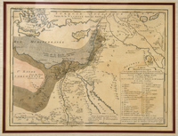 |
1751 Map of Egypt, Palestine, and Syria. Hand-tinted map entitled "Carte Minéralogique Sur la Nature du Terrein…de "Egypte, de la Palestine et de la Syrie Dressée en 1751 par Philippe Buache," 11¼x15". Fine; center fold. Matted to 16¾x20¼" and ready for framing. Areas with various types of mineral are identified, as well as hot springs, sulphuric fountains, lead, marble, granite, alabaster, etc.
Estimated Value $150 - 200.
View details and enlarged photo
| Realized
$127 |
Lot 355 |
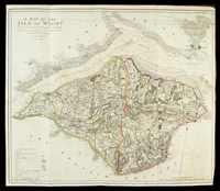 |
1781 Map of the Isle of Wight. 20¼" x 23" highly-detailed, hand-colored, by John Haywood, from surveys in the possession of Sir Richard Worsley. Illustrated legend notes churches, noblemen and gentlemens seats, villages, farms and cottages, mud or ooze, etc. Also shows depth soundings in the Solent Sea and Spit Head. One 2½" tape repair on right side, not affecting the island, a 1½" fold split at top edge and normal map folds. Fine.
Estimated Value $150 - 250.
View details and enlarged photo
| Realized
$86 |
Lot 356 |
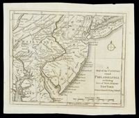 |
18th Century Map of Country Around Philadelphia. "A Map of the Country round Philadelphia including Part of New Jersey New York Staten Island & Long Island," 7½" x 9" map. Revolutionary War era, from a British publication; measurements are shown in British statute miles and the longitude from London is given. Two light vertical folds, else fine.
Estimated Value $150 - 200.
View details and enlarged photo
| Realized
$334 |
Lot 357 |
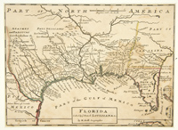 |
18th Century Map of Florida by H. Moll, c. 1730s. "Florida. Called by ye French Louisiana &c." 7½" x 10¼". Showing part of the Carolinas, the "Missisipi Mouth or R. St. Louis" and naming several Indian tribes, plus "Wandering Indians Antropophages." Very good; some light uneven toning.
Estimated Value $300 - 400.
View details and enlarged photo
| Realized
$173 |
Lot 358 |
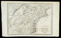 |
"A Correct Map of North America," 1802. Engraved by Holborn after the 1790s map by Hogg, and, according to a penciled note in the margin, published in Joseph Wooten's "Geography," Manchester, England, 1802, 8½" x 12". With inset, "Supplement to Carolina." Fine.
Estimated Value $250 - 350.
View details and enlarged photo
| Realized
$144 |
Lot 359 |
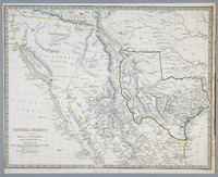 |
"Central America II, Including Texas, California And The Northern States of Mexico". Published under the Superintendence of the Society for Diffusion of Useful Knowledge by Chapman & Hall, 15 Oct. 1842. 12" x 15½", some outline coloring. California is shown as a peninsula and Texas (which would become a state in 1845) is huge, encompassing parts of several other present-day states. Very fine.
Estimated Value $250 - 350.
View details and enlarged photo
| Realized
$360 |
Lot 360 |
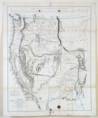 |
"Map of Oregon and Upper California from the Surveys of John Charles Fremont and Other Authorities…". Drawn by Charles Preuss and published in "Washington City," 1848. Image measures approximately 33" x 26½". Some outline color. From Geographical Memoir upon Upper California. Showing the entire West from Ft. Laramie. Along the top is "Profile of the traveling route from the South Pass of the Rocky Mountains to the Bay of San Francisco." Very good; scattered toning, most concentrated at lower right; several dark spots at upper and lower edges. Ref: Wheat (TM) 559 illus; Goss (NA #77; Schwartz pl. 171.
Estimated Value $800 - 1,200.
View details and enlarged photo
| Realized
$510 |
Lot 361 |
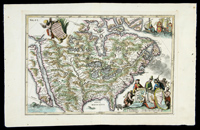 |
"Provinci Borealis Americae Americae non its Pridem Detectae aut Magis ab Europaeis Excultae." By Heinrich Scherer. Published Munich c. 1702-1710 in Scherer's "Atlas Marianus." An early view of California as an island. Image is 9½" x 14"; hand coloring may be later. Small title cartouche at upper left. Cartouche at lower right has three figures representing France, Spain, and England; each holds map of the regions his country controls. At upper right are three ships, each bearing the coat of arms of one of the three countries. Two sea creatures swim in the seas at the lower edge. Excellent condition; a few specks to outer margins. Ref: McLaughlin 160; Tooley (Amer.) p. 131, #86.
Estimated Value $1,000 - 1,500.
View details and enlarged photo
| Realized
$1,725 |
Lot 362 |
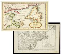 |
Two 18th Century French Maps of Parts of North America, by Bonne and Bellin (1) "Carte de la partie Nord, des Etats Unis, de l'Amérique Septentrionale," by M. Bonne, 9½" x 13¼", c. 1780. From Maryland up through the New England states. On laid paper. Fine; light toning. (2) "Carte du Golphe de St. Laurent et Pays Voisin…." (Bellin), hand-colored, 8½" x 14", c. 1770s. Includes Newfoundland, the Gaspe region, and the "Country of the Eskimos." Fine.
Estimated Value $250 - 350.
View details and enlarged photo
| Realized
$144 |
Lot 363 |
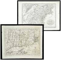 |
Two 18th Century Maps of Parts of North America (1) Part of North America Comprehending the Course of the Ohio, New England, New York, New Jersey, Pennsylvania, Maryland, Virginia, Carolina & Georgia," plus an inset, "Supplement to Carolina," (by Hogg, issued in Anderson's Collection of Voyages, c.1790s). Plate size 8½" x 12". Very fine; light central vertical file fold. (2) "A Map of Connecticut and Rhode Island With Long Island Sound, &c.; plate is 7½" x 9". From Gentleman's Magazine, c. 1776.; Fine except for light off-sett print.
Estimated Value $300 - 400.
View details and enlarged photo
| Realized
$230 |
Lot 364 |
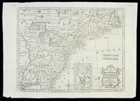 |
Map With Boundaries of French & Indian War Treaty, 1763. "A New Map of the British Dominions in North America; with the Limits of the Governments annexed thereto by the late Treaty of Peace and settled by Proclamation, October 7th, 1763," with small inset of East Florida, 9¾" x 12", engraved by T. Kitchin "for the History of the War in the Annual Register…for 1763." Very fine; on laid paper; couple of old file folds and one margin chip.
Estimated Value $250 - 350.
View details and enlarged photo
| Realized
$345 |
Lot 365 |
 |
1925 National Highways Airport Map. Aproximately 43" x 15.5" color map of a proposed national highway system showing planned airports 25 miles apart along the coast to coast highway route. Has been folded with some small holes at the folds and minor chips and tears at the edges. Scarce.
Estimated Value $150 - 200.
View details and enlarged photo
| Unsold |
Lot 366 |
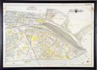 |
Quartet of Early Los Angeles Street Maps. A group of 4 very large, aprox. 34" x 24", colored and canvas backed street maps of various parts of the city from "Baist's Real Estate Atlas of Surveys of Los Angeles", ca. 1910. Plate 5 covers north of downtown and the Southern Pacific Railroad yards; Plate 6 north of downtown, Sunset Blvd. and Chinatown; Plate 24 East LA east of the LA River between 6th & 9th Sts. and Plate 26 showing the area southeast of downtown and Eastlake Park. The first framed and glazed with some paper loss at the folds and some edge chipping; the other three with a center fold, aging to the paper and minor age flaws. Total 4 maps.
Estimated Value $400 - 500.
View details and enlarged photo
| Unsold |
|
|